Road stopping places on state roads, Western Australia
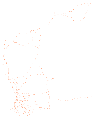
liveThe Road Stopping Places layer of Main Roads Western Australia, read from the layer on the publisher's own map service. Each row is one stopping place on a state road, with the road and straight line kilometre, the local government area and region, the rest area type and name, the 24 hour stay rule, the surface and the facilities the publisher records, the publisher's GlobalID for the site, and the point's longitude and latitude.
Also called: Road Stopping Places, Western Australia rest areas, Main Roads WA rest areas, 24 hour rest areas WA.
- What is in each row?
- One stopping place on a Western Australian state road, with its road, the straight line kilometre where it sits, its local government area and Main Roads region, its type and name, whether a 24 hour stay is allowed, and the facilities recorded there, such as toilets, tables, bins, shelter, shade and lighting.
- Can I stay overnight at a stopping place?
- The publisher records
Yes,NoorUnknownfor a 24 hour stay at each site, and the column is kept as published. Signs at each site and the managing authority set the rules. - Which roads are covered?
- The layer shows stopping places and rest areas on all state roads in Western Australia, of three kinds the publisher names as parking, short break and long break. Sites on local roads are not included.
Made for agents
Connect your AI agent
Any agent that connects to publicdata.au/mcp can find this dataset, read its 38 fields, count and filter across all 1,677 rows and diff its versions. Every answer names the version and carries Main Roads WA's attribution. No key.
Then ask it: What does Road stopping places on state roads, Western Australia hold, and what changed in the newest version?
claude mcp add --transport http publicdata https://publicdata.au/mcpOne command. No key, no account, no sign-up.
Settings, then Connectors, then Add custom connector, and paste https://publicdata.au/mcp.
On the web and in the desktop app.
Open https://chatgpt.com/plugins/plugin_asdk_app_6abbc4cec1a08191b61eaccfe2091100 and connect the publicdata.au plugin.
Listed in ChatGPT's plugin directory. publicdata.au asks for no key and no account.
https://publicdata.au/mcpStreamable HTTP. Cursor, VS Code or any client that connects to a remote MCP server.
Using https://publicdata.au/llms.txt, how many people died on Queensland roads in 2025, by month?For an assistant that reads the web and has no connector.
A dashboard over every row. Click to filter, add panels, share a link or embed a frame.
Query APIFilter and count from a URLaggregate?group=rest_area_type&metric=count
Stopping places of each type: 1,271 Minor Rest Area, 240 Heavy Vehicle Rest Area, 126 Major Rest Area, 40 Roadhouse.
Download it as Excel, CSV, JSON and 8 more formats
Pick a format and a version. Excel is picked first because it opens in the tools most offices have. The URL is yours to keep. A dated version keeps its content.
One workbook with a records sheet of 1,677 typed rows, a fields sheet and a publicdata sheet with the provenance. Dates are real Excel dates. Opens in Excel, Numbers, LibreOffice and Sheets.
UTF-8 without a byte-order mark, RFC 4180 quoting, one header row using the normalised field names. Opens in Excel, Numbers and Sheets.
One object with a publicdata header (publisher, licence, attribution, version, source hash), a fields list and a records array of 1,677 objects with typed values. Blank cells are null.
A FeatureCollection with one Point per row and every field as a property. Rows without coordinates have a null geometry. Ready for QGIS, Leaflet, MapLibre and geopandas.
Columnar and typed. The smallest download and the fastest to query. Reads directly in DuckDB, pandas, Polars, Arrow and Spark. The provenance header is in the file metadata.
One database with a records table, a fields table and a publicdata metadata table. Open it with any SQLite client.
One DuckDB database with a records table of typed columns, a fields table and a publicdata metadata table. It attaches read-only over HTTPS, so DuckDB, Python and R can query it without downloading it.
A GeoPackage with one point layer, records, in the publisher's coordinate system, plus the fields and publicdata tables. Drag it into QGIS or ArcGIS.
GeoParquet: the Parquet table with a WKB geometry column and its coordinate system in the file's geo metadata. Reads directly in DuckDB, GeoPandas, QGIS and GDAL.
The first line is the provenance header, then one JSON object per line. For streaming and for tools that read line by line.
The same CSV, gzipped, at about a tenth of the size. curl, pandas, DuckDB and R read it directly.
In your own tools
Use it in Excel, R, Python and more
Excel and Power BI read the CSV from its address and refresh from it. The R and Python packages take any dataset on this site by its slug, so a new dataset needs no new release. The DuckDB file attaches read-only over HTTPS, and a query reads only the blocks it touches.
The dated URL in the code never changes. https://publicdata.au/d/wa-road-stopping-places/latest/ redirects to the newest version.
https://publicdata.au/d/wa-road-stopping-places/latest/data.csvIn Excel choose Data, then From Web, and paste this address. Excel keeps it, so Refresh All reads the newest version. A sheet holds about a million rows; past that, load the query to the Data Model.
https://publicdata.au/d/wa-road-stopping-places/latest/data.csvIn Power BI Desktop choose Get data, then Web, paste this address and choose Anonymous when asked how to sign in. A scheduled refresh reads the same address, so the report follows each new version.
library(publicdataau)
df <- pd_read("wa-road-stopping-places")
pd_attribution(df)install.packages("publicdataau"). pd_read() fetches the version's Parquet file; pd_rows() and pd_aggregate() ask the query API instead, and pd_connect() attaches the DuckDB file.
import publicdata_au as pd_au
df = pd_au.read("wa-road-stopping-places")
df.attrs["publicdata"]["attribution"]pip install "publicdata-au[pandas]". read() fetches the version's Parquet file; rows() and aggregate() ask the query API, and connect() attaches the DuckDB file.
INSTALL httpfs; LOAD httpfs;
ATTACH 'https://publicdata.au/d/wa-road-stopping-places/v/2026-11-13/data.duckdb' AS wa_road_stopping_places (READ_ONLY);
SELECT road, count(*) FROM wa_road_stopping_places.records GROUP BY 1 ORDER BY 2 DESC;The DuckDB file attaches read-only over HTTPS and only the blocks a query touches are read. Parquet works the same way: FROM read_parquet(url).
const res = await fetch("https://publicdata.au/api/v1/datasets/wa-road-stopping-places/aggregate?group=rest_area_type&metric=count");
const { rows, publicdata } = await res.json();
console.log(rows, publicdata.attribution);The query API answers a page on any site as well as Node, with no key. It returns the rows and the attribution the licence asks for.
What is in it
Column names are made snake_case and the publisher's original header is kept beside each one. Blank cells are null. Nothing is added, removed, ranked or summarised.
| Field | Type | Publisher's header | Note |
|---|---|---|---|
| x | number | (longitude) | Decimal degrees, WGS84. |
| y | number | (latitude) | Decimal degrees, WGS84. |
| objectid | integer | OBJECTID | |
| globalid | string | GlobalID | The publisher issues a new GlobalID for every site each time it republishes the layer, so a site's GlobalID differs from one version to the next. The road, start straight line kilometre, carriageway and cross section position together identify a site. |
| road | string | ROAD | |
| road_name | string | ROAD_NAME | |
| common_usage_name | string | COMMON_USAGE_NAME | |
| start_slk | number | START_SLK | |
| end_slk | number | END_SLK | |
| cwy | string | CWY | |
| start_true_dist | number | START_TRUE_DIST | |
| end_true_dist | number | END_TRUE_DIST | |
| network_type | string | NETWORK_TYPE | |
| ra_no | string | RA_NO | |
| ra_name | string | RA_NAME | |
| lg_no | string | LG_NO | |
| lg_name | string | LG_NAME | |
| xsp | string | XSP | |
| rest_area_type | string | REST_AREA_TYPE | |
| stay_24_hour | string | STAY_24_HOUR | |
| rest_area_name | string | REST_AREA_NAME | |
| ownership | string | OWNERSHIP | |
| information_board | boolean | INFORMATION_BOARD | |
| scenic_lookout | boolean | SCENIC_LOOKOUT | |
| commemoration_way | string | COMMEMORATION_WAY | |
| surface | string | SURFACE | |
| surface_type | string | SURFACE_TYPE | |
| surface_area | integer | SURFACE_AREA | |
| constructed_shelter | boolean | CONSTRUCTED_SHELTER | |
| natural_shade | boolean | NATURAL_SHADE | |
| lighting_present | string | LIGHTING_PRESENT | |
| number_of_bins | integer | NUMBER_OF_BINS | |
| number_of_toilets | integer | NUMBER_OF_TOILETS | |
| accessible_toilets | boolean | ACCESSIBLE_TOILETS | |
| effluent_dump_site | boolean | EFFLUENT_DUMP_SITE | |
| number_of_tables | integer | NUMBER_OF_TABLES | |
| accessible_tables | boolean | ACCESSIBLE_TABLES | |
| route_ne_id | number | ROUTE_NE_ID |
Download this table as a data dictionary (Excel), or read it as a Frictionless Table Schema at schema.json. The key is road, start_slk, cwy, xsp.
The first 10 rows
From the latest version, in the publisher's order, with every field. A blank cell is shown as null.
| x | y | objectid | globalid | road | road_name | common_usage_name | start_slk | end_slk | cwy | start_true_dist | end_true_dist | network_type | ra_no | ra_name | lg_no | lg_name | xsp | rest_area_type | stay_24_hour | rest_area_name | ownership | information_board | scenic_lookout | commemoration_way | surface | surface_type | surface_area | constructed_shelter | natural_shade | lighting_present | number_of_bins | number_of_toilets | accessible_toilets | effluent_dump_site | number_of_tables | accessible_tables | route_ne_id |
|---|---|---|---|---|---|---|---|---|---|---|---|---|---|---|---|---|---|---|---|---|---|---|---|---|---|---|---|---|---|---|---|---|---|---|---|---|---|
| 117.540390457 | -34.3522705981 | 915853 | {0BFE7624-5401-4A40-BD3E-7BF544D5194D} | H001 | Albany Hwy | Albany Hwy | 324.02 | 324.02 | Single | 323.61 | 323.61 | State Road | 01 | Great Southern | 304 | Cranbrook | Left | Minor Rest Area | No | null | Main Roads | false | false | null | Unsurfaced | null | null | false | true | null | 1 | 0 | false | false | 0 | false | 247561 |
| 121.698133514 | -33.3929741271 | 915854 | {96A8063A-3154-4DDB-BA5A-946BF36D63C9} | H010 | Coolgardie Esperance Hwy | Coolgardie Esperance Hwy | 310.25 | 310.25 | Single | 310.36 | 310.36 | State Road | 05 | Goldfields - Esperance | 604 | Esperance | Left | Minor Rest Area | No | null | Main Roads | false | false | null | Unsurfaced | null | null | false | false | null | 1 | 0 | false | false | 0 | false | 247618 |
| 114.695780417 | -27.8472258712 | 915855 | {0903CC64-FCEC-4A5C-A349-53E296AE9BE3} | H007 | North West Coastal Hwy | North West Coastal Hwy | 111.77 | 111.77 | Single | 111.74 | 111.74 | State Road | 14 | Mid West-Gascoyne | 513 | Northampton | Left | Minor Rest Area | No | null | Main Roads | false | false | null | Unsurfaced | null | 2250 | false | false | null | 2 | 0 | false | false | 0 | false | 247803 |
| 119.716369092 | -24.0725845243 | 915856 | {F6024DA4-BF42-434A-A2A3-9C674EBF5611} | H006 | Great Northern Hwy | Great Northern Hwy | 1078.03 | 1078.03 | Single | 1071.62 | 1071.62 | State Road | 11 | Pilbara | 703 | Meekatharra | Left | Minor Rest Area | No | null | Main Roads | false | false | null | Unsurfaced | null | null | false | false | null | 1 | 0 | false | false | 0 | false | 247653 |
| 127.444631446 | -31.9148637052 | 915857 | {EADC282D-5D1F-4006-87C3-AB5EF852471B} | H003 | Eyre Hwy | Eyre Hwy | 568.2 | 568.2 | Single | 567.73 | 567.73 | State Road | 05 | Goldfields - Esperance | 603 | Dundas | Left | Minor Rest Area | No | null | Main Roads | false | false | null | Unsurfaced | null | null | false | false | null | 1 | 0 | false | false | 0 | false | 247631 |
| 116.717440794 | -31.6349523152 | 915858 | {3DFB801E-9246-48B2-AE94-A58E20DE9FAE} | H005 | Great Eastern Hwy | Great Eastern Hwy | 100.8 | 100.8 | Right | 100.34 | 100.34 | State Road | 08 | Wheatbelt | 421 | Northam | Right | Minor Rest Area | No | null | Main Roads | true | false | null | Surfaced | Two Coat Seal | 2500 | true | true | Powered Site | 2 | 0 | false | false | 0 | false | 247651 |
| 116.682492618 | -28.3461724492 | 915859 | {4F20DDCB-31CA-4B72-AAD4-4C5E4FE872A1} | H050 | Geraldton Mt Magnet Rd | Piesse St | 214.21 | 214.21 | Single | 214.55 | 214.55 | State Road | 14 | Mid West-Gascoyne | 707 | Yalgoo | Right | Minor Rest Area | No | null | Other | true | false | null | Surfaced | Rubberised Seal | 1186 | true | false | null | 2 | 1 | false | false | 3 | false | 247642 |
| 126.822437953 | -18.7512782544 | 915860 | {A06361B8-721B-48F5-8443-59B802EDE0B1} | H006 | Great Northern Hwy | Great Northern Hwy | 2697.19 | 2697.19 | Single | 2705.25 | 2705.25 | State Road | 06 | Kimberley | 002 | Halls Creek | Left | Minor Rest Area | No | null | Main Roads | false | false | Savannah Way | Unsurfaced | null | null | false | false | null | null | null | false | false | null | false | 247653 |
| 121.607750428 | -31.5771899972 | 915861 | {7548C46D-8902-4699-A8D4-E71E0D9B5C65} | H010 | Coolgardie Esperance Hwy | Coolgardie Esperance Hwy | 85.73 | 85.73 | Single | 85.84 | 85.84 | State Road | 05 | Goldfields - Esperance | 602 | Coolgardie | Left | Minor Rest Area | No | null | Main Roads | false | false | null | Unsurfaced | null | null | false | false | null | 2 | 0 | false | false | null | false | 247618 |
| 116.185876851 | -31.9053819052 | 915862 | {3E56D949-4911-488B-9040-05ABEB44E5B8} | H005 | Great Eastern Hwy | Great Eastern Hwy | 32.94 | 32.94 | Left | 33.13 | 33.13 | State Road | 07 | Metropolitan | 106 | Mundaring | Left | Minor Rest Area | No | null | Main Roads | false | false | null | null | null | null | false | false | null | 1 | 0 | false | false | 0 | false | 247651 |
The first row as JSON
As it appears in data.json.
GET https://publicdata.au/d/wa-road-stopping-places/latest/data.json
{
"x": 117.54039045700007,
"y": -34.35227059812058,
"objectid": 915853,
"globalid": "{0BFE7624-5401-4A40-BD3E-7BF544D5194D}",
"road": "H001",
"road_name": "Albany Hwy",
"common_usage_name": "Albany Hwy",
"start_slk": 324.02,
"end_slk": 324.02,
"cwy": "Single",
"start_true_dist": 323.61,
"end_true_dist": 323.61,
"network_type": "State Road",
"ra_no": "01",
"ra_name": "Great Southern",
"lg_no": "304",
"lg_name": "Cranbrook",
"xsp": "Left",
"rest_area_type": "Minor Rest Area",
"stay_24_hour": "No",
"rest_area_name": null,
"ownership": "Main Roads",
"information_board": false,
"scenic_lookout": false,
"commemoration_way": null,
"surface": "Unsurfaced",
"surface_type": null,
"surface_area": null,
"constructed_shelter": false,
"natural_shade": true,
"lighting_present": null,
"number_of_bins": 1,
"number_of_toilets": 0,
"accessible_toilets": false,
"effluent_dump_site": false,
"number_of_tables": 0,
"accessible_tables": false,
"route_ne_id": 247561.0
}
Query it without downloading
The query API returns only the rows you ask for, as JSON, NDJSON or CSV, from the same typed rows as the files. It needs no key. Build a query here and run it, then copy the URL or the code into your own work.
How filters work
Each filter is field=operator.value in the query string, and every filter must match. A number or date field compares as a number or date, and a text field compares as text. Values are case-sensitive, except that like and ilike ignore case in the ASCII letters A to Z. Prefix not. to negate a filter, as not.eq.value.
| Operator | What it matches |
|---|---|
| eq.value | Equal to the value. |
| neq.value | Not equal to the value. A blank cell does not match. |
| gt.value | Greater than the value. |
| gte.value | Greater than or equal to the value. |
| lt.value | Less than the value. |
| lte.value | Less than or equal to the value. |
| like.*text* | Matches a pattern where * stands for any run of characters, ignoring case in the ASCII letters A to Z. |
| ilike.*text* | The same as like. Both ignore case in ASCII letters only, so É and é differ. |
| in.(a,b,c) | Equal to any value in the list. A value cannot contain a comma. |
| is.null | Blank in the source, or suppressed by the publisher. |
| Parameter | What it does |
|---|---|
| select | Fields to return, comma-separated. Every field when absent. |
| order | field.asc or field.desc, comma-separated. When absent, rows come in the order of the file they are read from. For the newest versions that is the version's own data.parquet, which keeps the publisher's order unless the dataset sorted it. Any other version is read from the Parquet file the answer names in file, and when that file is sorted the answer names its sort in order, which ties follow too. |
| limit | Rows per page, 1 to 10,000. 100 when absent. |
| offset | Rows to skip. The next URL in each answer sets it for you. |
| group | On aggregate, fields to group by, comma-separated. |
| metric | On aggregate, count, sum.field, avg.field, min.field or max.field, comma-separated. count when absent. |
| format | json, ndjson or csv. JSON carries the provenance header, and the others carry it in response headers. |
Without a version the API answers from the newest version, and that answer changes when the publisher releases again. Put versions/<date>/ before rows or aggregate for an answer from that version alone. Every version with a table can be queried, and /api/v1/datasets/<slug>/versions lists them. A query on a version the database does not hold is read from its Parquet file, and one that would read too much of it is refused with DuckDB SQL that answers it from the file. The 2 newest versions are loaded; versions lists them.
The API allows 60 requests in 10 seconds from one address. Above that it answers 429 for 10 seconds with a Retry-After header, a RateLimit-Policy header and a JSON body that gives the limit. Every API answer carries the same RateLimit-Policy. A client should wait the Retry-After seconds, or read the files, which have no limit. openapi.json describes this dataset's query paths for client generators and agents.
https://publicdata.au/mcp is a remote MCP server over Streamable HTTP with the same tools, defined in the same place, so a tool added to the pages is added here too. It needs no key and no account. Its row tools and the query API answer every version through one query path, so a tool's answer and the query URL it cites give the same rows. A query that would read too much of a file is refused with DuckDB SQL that answers it from the file. It also has search and fetch, the two tools ChatGPT's deep research and company knowledge call by name, which run search_datasets and read a dataset's record in the shapes those features expect. The row tools are held to the query API's limit of 60 queries in 10 seconds from one address, and each call is two queries because it also counts the matching rows. Add it to Claude Code with claude mcp add --transport http publicdata https://publicdata.au/mcp, add the URL in Claude as a custom connector, connect the publicdata.au plugin in ChatGPT, or give it to any client that connects to remote MCP servers. Each dataset with a table is also a resource at https://publicdata.au/d/<slug>/fields.json, which lists its fields with their types, the publisher's descriptions, their ranges and the values they hold, so an agent can read a dataset's shape before it writes a query.
What changed
One version for every release the publisher has made since this site started following the dataset. The date is the day the file changed on the portal.
- 2026-11-13 1,677 rows+0 added −0 removed 1677 changed38 fieldsutf-8179c71d01530
The layer states no edit date or dated records, so this version is dated by the portal record.
The publisher offers no file. These bytes are every feature of the layer as the service returned them in WGS84, ordered by its object id, so the same layer gives the same bytes.
- 2026-11-06 1,677 rows+0 added −0 removed 1677 changed38 fieldsutf-8d66f2955baf6
The layer states no edit date or dated records, so this version is dated by the portal record.
The publisher offers no file. These bytes are every feature of the layer as the service returned them in WGS84, ordered by its object id, so the same layer gives the same bytes.
- 2026-10-30 1,677 rows+0 added −0 removed 1677 changed38 fieldsutf-8403b8cf3b147
The layer states no edit date or dated records, so this version is dated by the portal record.
The publisher offers no file. These bytes are every feature of the layer as the service returned them in WGS84, ordered by its object id, so the same layer gives the same bytes.
- 2026-10-22 1,677 rows+43 added −30 removed 1634 changed38 fieldsutf-8cdcfe4e87461
The layer states no edit date or dated records, so this version is dated by the portal record.
The publisher offers no file. These bytes are every feature of the layer as the service returned them in WGS84, ordered by its object id, so the same layer gives the same bytes.
- 2024-09-20 1,664 rows38 fieldsutf-8-sig7527313864cc
On 26 October 2026 this version's database files were written again with the longitude and latitude descriptions the register entry gained on 24 October 2026, when it moved to the publisher's map service. The rows are unchanged.
versions.json · changes.json · history.tar.zst (456 KB, every version's Parquet and manifest)
Questions
How do I download Road stopping places on state roads as a CSV file?
Open https://publicdata.au/d/wa-road-stopping-places/latest/data.csv. It redirects to the newest dated version, which is https://publicdata.au/d/wa-road-stopping-places/v/2026-11-13/data.csv today. The same path serves Excel, JSON, GeoJSON, Parquet, SQLite, DuckDB, GeoPackage, GeoParquet, NDJSON. A dated URL never changes, so use it when the file must stay the same.
Can I open Road stopping places on state roads in Excel?
Yes. https://publicdata.au/d/wa-road-stopping-places/v/2026-11-13/data.xlsx is a workbook with the 1,677 rows on a records sheet, the field list on a second sheet and the provenance on a third. The CSV also opens in Excel. https://publicdata.au/d/wa-road-stopping-places/v/2026-11-13/data.csv.gz is the CSV at about a tenth of the size.
How often is Road stopping places on state roads updated?
Main Roads WA releases it as stopping places change. This site checks the portal every week and adds a dated version when the file changes.
Can I use Road stopping places on state roads commercially?
Yes. CC BY 4.0 allows commercial use, redistribution and derived works as long as the attribution is kept. The attribution string is in this page's side column and inside every file.
Is this the official source for Road stopping places on state roads?
No. The publisher is Main Roads Western Australia, and its page is https://catalogue.data.wa.gov.au/dataset/mrwa-road-stopping-places. National Digital converted the publisher's file to other formats. It renamed and typed the columns and kept only those the schema lists. National Digital made these changes, and the publisher is not responsible for them. The original sits beside every version as source.geojson with its SHA-256, so the two can be compared.
What coordinate system does Road stopping places on state roads use?
Longitude and latitude in decimal degrees, which the map service projects to WGS84 on request. The 2024-09-20 version holds the X and Y columns of the portal's CSV download. The layer itself is held in GDA94, which differs from WGS84 by under 2 metres. The GeoJSON file uses the same coordinates, which is what GeoJSON expects.
What this site did to the data. Cells were typed, headers were renamed and the encoding was made UTF-8. Rows were left alone. The publisher's file sits beside every version as source.geojson so the change can be checked.
The licence requires the publisher's attribution. We ask that you also name publicdata.au and link to the version you used.
Main Roads Western Australia, Government of Western Australia, Road Stopping Places, https://catalogue.data.wa.gov.au/dataset/mrwa-road-stopping-places, accessed 16 November 2026, licensed under CC BY 4.0. The Commissioner of Main Roads is the creator and owner of the data and Licenced Material, which is accessed pursuant to a Creative Commons (Attribution) Licence, which has a disclaimer of warranties and limitation of liability. Serialised and versioned by National Digital at publicdata.au, https://publicdata.au/d/wa-road-stopping-places/v/2026-11-13/
The map's state outlines are from the ABS Australian Statistical Geography Standard 2021, under CC BY 4.0.
The attribution alone is inside every file. Harvard is the author-date form a report or a brief asks for. Paste the HTML on a web page so the links carry.
Main Roads Western Australia states the licence, CC BY 4.0, on its own page, which was read and recorded here on 23 October 2026.
Every fetch reads the licence again and stops when it has changed. The fetch that made version 2026-11-13 read it from catalogue.data.wa.gov.au on 16 November 2026.
- Hugging Faceload_dataset("National-Digital/wa-road-stopping-places")
- Kagglewith a starter notebook
- ZenodoDOI 10.5281/zenodo.23486169
Each copy carries the same attribution and links back to this page.
- datapackage.jsonFrictionless data package pointing at the latest version
- schema.jsonTable Schema for every field
- schema.xlsxthe same field list as an Excel data dictionary
- versions.jsonevery version with date, rows, fields and hash
- changes.jsondiff for every consecutive pair
- manifest.jsonwhere the bytes came from and when
- Query APIfiltered rows and counts without a download
- openapi.jsonOpenAPI 3.1 for this dataset's query paths
- explore/charts and dashboards in the browser, shareable and embeddable
- index.mdthis page as Markdown
This page carries a schema.org Dataset record and is listed in /.well-known/ard.json and /catalog.json.
Main Roads Western Australia publishes this table on gisservices.mainroads.wa.gov.au. Questions about the content go to the publisher. Questions about the files here go to corrections.
Fetched 16 November 2026. Source SHA-256 179c71d015309ba4…
This page is built from register/wa-road-stopping-places.yaml on GitHub. Anyone can propose a fix to it, such as a clearer description or a field the publisher renamed, as a pull request.
Report a file that differs from the publisher's · How to contribute